Ley Lines Of The Midwest
This is now unexpectedly a geography blog.
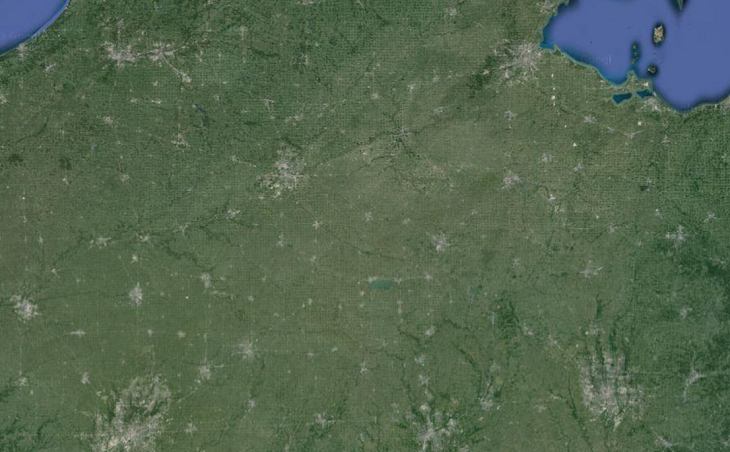 That’s Ohio and Indiana as seen from space.
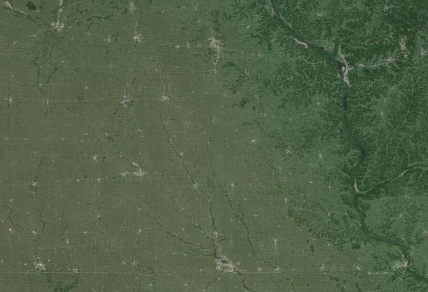 And that’s Northern Iowa and Southern Minnesota as seen from space.
Each small grey dot is a town. Are there straight horizontal or vertical lines that connect more than a chance number of towns? And are the towns arranged in a consistent coordinate grid pattern?
As best I can tell there are a few short straight lines probably representing more-used local roads, but few that persist across entire states. I don’t think there’s any consistent grid pattern. This is the opposite of my initial impression, which was that there was a clear and striking coordinate grid. But when I try to measure the native unit of the coordinate grid, I find that my mind is confusing a whole bunch of vaguely square-ish patterns into one illusory system.
There is a square pattern to the Midwest, deriving from the Public Land Survey System, but its scale is 6 mile x 6 mile squares, which is smaller than any of the distances on either of these maps. There is supposedly a higher level of grid, the 24 mile x 24 mile quadrangle, but it doesn’t seem to be as important and I don’t see that on this map either.
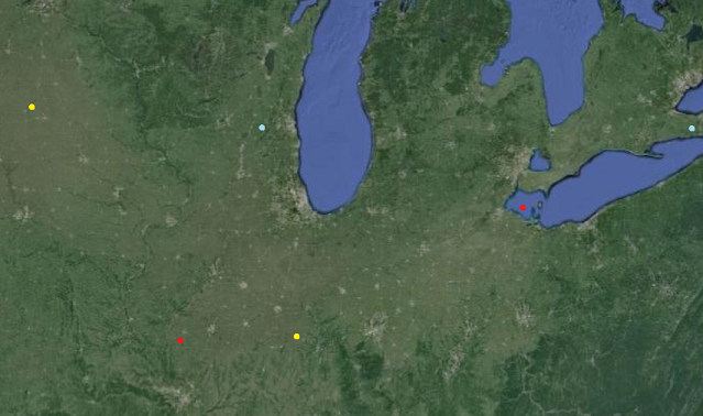 I titled this post “Ley Lines” as a joke, but we might as well see if there are any actual ley lines. The best candidates seem to be the cities between the yellow dots – which are Waterloo, Davenport, Peoria, Bloomington, and Champaign – and the cities between the red dots – which are Springfield, Champaign, Lafayette, Fort Wayne, and Toledo. If you want to stretch it, you could also imagine a horizontal line between the blue dots – Madison, Milwaukee, Grand Rapids, Flint, Sarnia, London, and continuing to Buffalo just off the map.
As far as I know there’s no explanation for any of these – no highways, no rivers, nothing – and they’re all just coincidences.
We had some interesting discussions about Midwestern geography during our last Michigan Rationalist Meetup. My favorite part was learning that the town of Zilwaukee, Michigan was named by two brothers hoping that would-be settlers on their way to Milwaukee would get confused and settle there instead. It sounds like a dumb urban legend, but it was previously admitted to on the Zilwaukee city website. I notice their new website doesn’t mention this, which means either that it’s been disproven or they decided to stop advertising to the world that they’re descended from morons.
[EDIT: And here’s a church website that uses Zilwaukee as a metaphor for the Devil]